

When you hear the word “drone,” it’s hard not to think about the unmanned attack drones flown from airbases and used to hunt down suspected terrorists. The term conjures up something close to the steely death machine of the Terminator seeking its prey.
However, despite that reputation, drones are actually developing into an innocuous and indispensable tool for litigation and other uses. For example, Amazon is currently testing them for same-day delivery in certain areas, and drones are used for creating amazing videos with high-definition cameras that are stunning. Their ability to film from overhead is where their use in litigation comes into play.
Unlike old camera-equipped model airplanes or helicopters, which had to be painstakingly controlled by someone who knew how to fly them, a drone can be pre-programmed to fly a set path that is highly accurate. When HD video capability is added to this aspect of control, you can essentially ask the drone to “map” by video an entire area by programing the drone to fly over and film repeating patterns of the area.
Combined with high-powered software, the video obtained during that “mapping” can then be turned into a highly accurate 3D model. The software basically interprets the video to determine the dimensions of all objects based on “seeing” the object from all different directions, which in turn creates a very accurate 3D model.
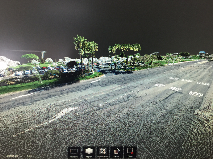
Below is a sample from a recent case Cogent Legal worked on showing the area of a vehicle accident. This flyover shows the 3D model created through the computer process described above. This 3D model can be viewed from any angle. Additionally, since the model is in a 3D environment, any changes can be made to it in order to re-create the conditions at the time of the incident.
Below are screen images taken from the street-level view showing the detail that the drone mapping obtains.
If you need to create a detailed model for your case to show what a driver could or could not see, then starting with a foundation obtained from a drone gets you a long way toward proving your case. All the various scaled vehicles can be added to this model and animated however the incident occurred.
Beyond auto cases, drone mapping and modeling could be used in litigation involving real estate disputes and land use, toxic torts and environmental cases, or construction defects.
To make your case presentation as compelling and accurate as possible by using a drone to create 3D models of the scene, contact us.
If you’d like to receive updates from this blog, please click to subscribe by email.